Check Your Code NewsBlog

|
15/9/2023 0 Comments Be Eircode "Where Aware"Those responsible for organisational health & safety, for safety infrastructure & those who provide emergency responce MUST take more care and be more "Where Aware" when it comes to Eircode ..... Where does it point to & Where does it lead to? Check both Location & Routing before having to rely on it especially in an emergency! 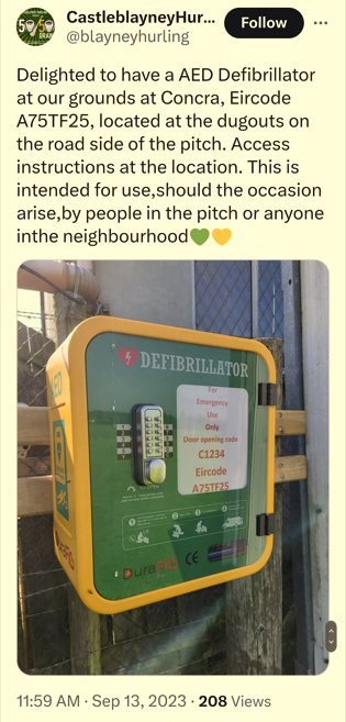 The Eircode shown both on the above Defib Cabinet and in the tweet is not at the Castleblayney Hurling Pitch. In fact, the Pitch has NO Eircode. We responded to the tweet raising concerns but without reply. The image above encapsulates everything we have been warning about when it comes to Eircode:-
Yet, the Department of Communications, Capita, who run Eircode, and An Post, who support the whole thing by the provision of their addressing system GeoDirectory, for more than 7 years have collectively failed to warn of these known issues and encourage the Public to be more Eircode "Where Aware" by checking their codes. Our last article on this matter here refers to the answer to a Parliamentary Question by Minister Eamon Ryan, who is responsible for Eircode, on 11th July last where he admits issues with Eircode and, therefore, that it can cause misrouting. Yet, the Public and, in this case, Castleblayney Hurling Club and the owner of the property who's Eircode they are using, have not been made aware of these issues and encouraged to check things thoroughly before relying on an Eircode for any aspect of emergency response. It is equally worrying that response agencies involved in identifying the location of the Defib and undertaking related Community Response have themselves not yet taken time to understand the issues and warn the Public either. Some of you might suggest that sure wont the Eircode shown get someone into the right area and the instructions in the tweet will make it clear that the Defib is in the Hurling Pitch. Unfortunately, this may be true for some very few but, as the marketing about Eircode has been that it is always unquestionably "precise", it has become the norm to communicate Eircodes without supporting address information or instructions. Eircode (Capita) encourage people to blindly put an Eircode into Google Maps or other and navigate to it. In this case, that would lead to the user ending up in the driveway of a private house;- maybe desperately searching around the building in the darkness of night for a Defib which would not only delay the use of the Defib to save someone's life but it could also also potentially cause an altercation between the property owner and the unwanted visitors. Of course, Community First Responders or an ambulance intended for the property at the Eircode shown could also misrouted to the wrong property. When the impression has been promoted that Eircode is precise without question;- responders are not prepared to consider the other possibilities and this is likely to cause confusion and delays. The notion that the "nearest Eircode" will do, as is now being widely suggested by State Agencies involved with and using Eircode, undermines the notion of precision imagined for the national postcode and belies the claim that it is the panacea for emergency response. To address you directly Minister Ryan (who under the terms of the Postal Act must control the "appropriate" non postal service use of the national postcode) it is clear from your PQ answers and other information, that you are very much aware of the issues with Eircode. Therefore, if you do not take urgent action to advise and guide the Public in order to avoid very predictable potential adverse outcomes associated with its use (misuse), it is inevitable that you and your Departmental Staff and their contractors will be held directly responsible. As for the Castleblayney Hurling Club, none of this is their fault. They have been badly advised and are the unsuspecting victims of misinformation. They need to be more "Where Aware" and take another look at the solution for them. They can feel free to contact us at www.checkyourcode.ie for free and professional advice.
0 Comments
In answers to two Parliamentary Questions (PQ's) from Brendan Griffin TD on 11th July 2023, the Minister for Communications identifies An Post as the organisation to contact if there is a location or address issue with Eircode and states that Satnav systems can misroute even if the Eircode location from An Post is correct. Effectively, even though the Department of Communications and Capita have been promoting Eircode for use when calling an ambulance since 2015, this is the first time that the potential for misrouting if an Eircode is used is publicly admitted. This is a Public Safety Issue. Neither Capita, who produced the Eircode ambulance advert, nor the Department, which approved that it could be broadcast by RTE as a Public Service Announcement (PSA) and paid for by TV license payers, have never previously publicly admitted that misrouting could occur if an Eircode is used. 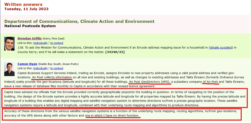 This blog has previously explained how misrouting occurs in SatNav systems and we have provided multiple examples of how it has delayed ambulances getting to patients on numerous verifiable occasions. (as well as causing confusion and delays for deliveries of goods and services) We have also shown that this is an issue that was well known to navigation industry experts before Eircode was ever conceived and that the designers of Eircode could and should have taken it into account. Furthermore, we have also shown in our blog posts that in the vast majority of cases simply moving the location of an Eircode by a small amount can solve the problem. However, this is not acknowledged in the answer to the PQ's referenced above and when one of the PQ's identifies An Post as responsible for Eircode location issues, it also directs the blame to An Post as An Post's design rules for Eircode do not permit movement of the related location away (even by a small distance) from that which is recorded in An Post's Geodirectory. By simply removing this rule, many of the misrouting issues identified to date could be immediately resolved. It is because Loc8 Code allows flexibility as to where the destination location is marked, it can resolve Eircode misrouting issues instantly and that is why we recommend it as a solution in our Guide to checking and resolving Eircode misrouting here It is notable that in his response to the PQ's that the Minister does not highlight that the Eircode Satnav routing issues which he refers to, could also misroute an ambulance and, as a result, there is a need for people to check their codes before relying on them in emergencies. This is in spite of the fact that his Department and Capita, under contract to the Department, with the support of An Post, promotes Eircode for emergency Navigation by the ambulance service through PSA's which have been repeated every year since 2015. Equally the Minister does not mention that even though both Capita and his Department have previously recommended that members of the Public contact Google Maps to ask them to solve the issue, there is never any mention that since the Ambulance Service does not use Google Maps (same for many others), resolving the issue with Google Maps may still leave the same misrouting issue for ambulances. We have also highlighted this in our related blog posts here Misrouting relating to Eircode use on Satnavs has been known about by those involved with Eircode since at least 2016. (Autoaddress was a subcontractor to Capita for the roll-out of Eircode) 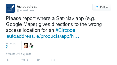 However, those directly responsible, especially Officials in the Department of Communications, have denied misrouting even when raised with them officially. Their denials have been accompanied by misinformation such as the idea that ambulances use Ordnance Survey of Ireland (OSI - now Tailte Éireann) mapping for Navigation (they use Trimble Maps in the Co-Pilot Navigation system) 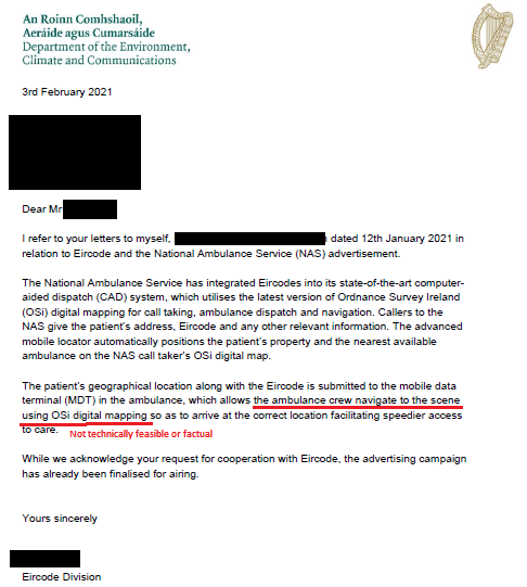 It is good, therefore, to finally have the Minister representing the Department of Communications officially admitting that that Eircode related misrouting does actually occur when his Officials & Contractors have previously failed to do that. He should now, therefore, commence a National and highly visible campaign to warn the Public that this may happen when an Eircode is used in calls to the ambulance service and, if the Eircode ambulance advert is to be broadcast as a PSA again, then it should also include that warning. This is a Public Safety Issue so all such warnings should advise the Public to check their codes and we at checkyourcode.ie are more than willing to work with the Department, Capita and An Post to facilitate that checking and help with the quick solutions if an Eircode does suffer from misrouting. Finally, when the Minister stated in his answer to the PQ that he has "no direct function" relating to the "accuracy of these directions" , this is NOT TRUE :-
The Minister's own Duty of Care to the Public he serves should dictate appropriate action once he has become aware of the related issues. The answer to this PQ confirms that he is now aware of Eircode related misrouting. You would imagine also that RTE and its new DG, Kevin Bakhurst, would no longer allow a Public Service Announcement be broadcast on its platforms without inherent warnings to the Public, since it is now officially acknowledged that the Minister is aware of related issues? Following on from our blog post 3 days ago - The Connaught Telegraph has published this article - Eircode misrouting should be tackled immediately in Mayo 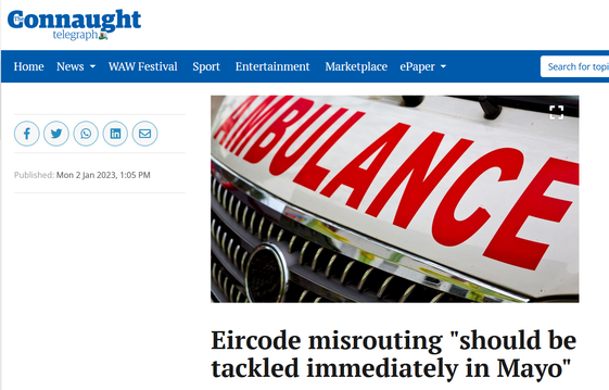 30/12/2022 Eircode Misrouting Identified by Councillors in Castlebar But Dangers For Residents Not Recognised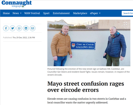 Here we are at the end of 2022, almost 9 years since Eircode was launched, and another case of Eircode misrouting is identified. This time it is being identified by Councillor Ger Deere and Iarla Moran, Head of the Municipal District, in Castlebar, Co Mayo, without understanding the potential dangers of this if a resident of the named street has to call for an ambulance. Instead of an Eircode which "directs" to the wrong street being a "not serious" "inconvenience" as suggested by the Connaught Telegraph Article, it could actually result in an ambulance being delayed getting to a patient in a case where minutes or maybe just seconds are critical. This is a particularly worrying possibility in a scenario where total reliance on Eircode and belief in its infallibility may have been created. It is just about 6 months since a similar article appeared in the Irish Examiner reporting confusion with street & estate names. In that article on the 24th of June last problems caused for Gardai were acknowledged.  What these articles are telling us is that Eircode has not fixed well known problems with property addressing in Ireland and , in fact, it seems to be associated with making matters worse as suggested in this article from 2017. It also tells us those who run our cities, municipalities and rural areas have been convinced by Public Service Announcements, marketing and political statements that Eircode is flawlessly precise and a perfect destination identifier for Navigation, when this Newsblog makes it abundantly clear that it is not. Furthermore, we can also see that there is confusion as to who is responsible. Because it was recognised before Eircode that we had significant issues with our property addressing system and because this appears to have deteriorated further in recent years, an over reliance on Eircode is being caused. Amongst the public in general and those who respond to emergencies, there is a bias that addresses cannot be relied upon at all so, they should be ignored in favour of total reliance on Eircode. In the professional discipline of Navigation, this is a recipe for disaster. Since it is well proven on this Newsblog that Eircode can & has misrouted, that disaster may well be related to the loss of life. I regret to say that, in the not too distant future, this subject may end up for consideration in a Coroner's Court where over reliance on Eircode, a failure to understand its limitations, the undermining of property addressing and all the people and factors that contributed to these, will be exposed in detail. Just like air or marine accident investigations, it will be found that contributing factors were obvious to those responsible for related oversight for some time but were consistently set-aside and/or ignored. Iarla Moran suggests in the Connaught Telegraph article that Eircode and street addressing have nothing to do with the Council. When it comes to property addressing, that is not entirely true but this article makes it clear that property addressing is nothing to do with Eircode. Nor is it anything to do with Google Maps. In fact, it is useful to know that the Postal Addressing associated with Eircode is not actually passed to Google Maps when Eircodes are passed on. However, as has been discussed in this Newsblog many times, it may be possible to resolve misrouting on Google Maps by making contact with Google BUT this does not assure that the same problem is resolved on other mapping and navigation systems used by emergency services or logistics companies. As we have highlighted before, the National Ambulance Service does not navigate to an Eircode location using Google Maps. We have to be very clear here, whilst property addressing is mainly an issue for An Post (with input from Local Authorities), Eircode misrouting is the sole responsibility of Capita which manages Eircode for the State. The misrouting wrongly identified as an "inconvenience" in the article should be brought to the attention of Eircode immediately and they must ensure that whatever steps are necessary to resolve the issue in ALL mapping and navigation systems, especially those used by emergency responders, are undertaken as a matter of urgency;- with unambiguous confirmations when achieved. As we reach the end of another year where evidence of the misrouting of ambulances has been prominent and the absence of warnings from those responsible has been conspicuous, we can only hope that 2023 will be better in the best interests of Public Safety for all residents in Ireland! We have been made aware of yet another case of Eircode misrouting where an ambulance was delayed as a result. For this reason, we have added a new "Point 5" to our list for checking an Eircode here -/>  On the afternoon of the 3rd November last, we received a call from a lady who had called an ambulance for her father a few days earlier but the ambulance was delayed as a result of Eircode misrouting. She made contact with us to confirm she could use a Loc8 Code when calling for an ambulance in the future. In this case, Google Maps had been corrected to include a short private driveway;- so if she had done our check and had not read our NewsBlog articles she would have assumed misrouting could not take place. However, there was another road running along a different side of her house from which there was no driveway but it was closer. CoPilot, which the ambulance service uses, did not have the corrected driveway to the house, so the ambulance ended up on the closer road from which there was no access to their patient and no visibility to or from the house. This caused a delay until all realised that there had been a misrouting error. For that reason, our new Point 5. states as follows: "5. If there is a road shown on Google Maps between your road access & your house, this road may not be on other mapping systems such as "CoPilot" which the ambulance service uses. If there is another road on the maps closer to your house than your own road access then, misrouting could occur and, therefore, you should also create & use a Loc8 Code to be safe. As different emergency responders and other service providers use different Navigation systems with different map suppliers, it is not possible to check them all. For that reason, best to be safe & use a Loc8 Code." In addition, because the actual access to this property from the road is very narrow and bordered on 2 sides by other houses, even with a Loc8 Code generated just inside the access point, there could still be doubt. For that reason we would recommend Confirmation Signage at the gate which would say "Access to Eircode &/or Loc8 Code xxxxxxxxx" This would remove any possibility of doubt amongst the paramedics navigating the ambulance. Confirmatory signage like this is very useful in navigation and is highly recommended where there might be any doubt. The responsibility for this kind of confirmation is on the property owner;- not the paramedics or other service providers trying to find them. It is extremely regrettable that those behind Eircode are not even warning the public about the possibility of errors or misrouting;- let alone advising how to check and resolve issues before they happen and cause risk to public safety. If you need any clarifications on any of this, please contact us here -/> 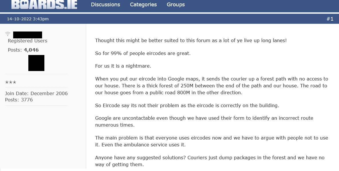 Misrouting of vehicles, including ambulances and 1st responders, by Eircode has been reported for many years now. New examples keep being reported through social media and that means there are many more that go unreported. The above image is from a post a few days ago in boards.ie and is just one more of many many examples. Those who report Eircode mis-routing in relation to deliveries do not always realise that the very same could happen if an ambulance is trying to find them........ ;- but with potentially life and death related consequences. Even though Eircode & the Department of Communications promote their product through Public Service Announcements (PSA's) on RTE for ambulance emergency response, they continue to fail to take any responsibility when a misrouting report raises the possibility of an ambulance being led astray and delayed. They also have taken no steps to warn the public about this well documented issue. Eircode misrouting is predictable and can be avoided. It is explained in detail in our post here -/> We are aware that in previous cases Capita personnel have advised those reporting the issue to contact Google Maps to get them to help solve the problem (not always possible or timely). Not only have they not admitted that by simply moving the location of the Eircode themselves they could resolve the problem, they also fail to advise those with the problem that even if they get the problem solved in Google Maps, the issue may well remain for ambulances as they use a different mapping system (CoPilot - Trimble Maps). Furthermore, other service providers may be using Garmin/Navigon, TomTom or other navigation/map systems which all would have to be contacted to fully (though possibly temporarily) correct a problem which Eircode created and could solve themselves. Unfortunately, Eircode will not do as required to resolve the matter as the An Post design specifications for Eircode limit what the code can point to. The quickest solution for those experiencing Eircode mis-routing is to generate a Loc8 Code for the access to the desired property using the web-app here -/> Then create a sign with the Loc8 Code on it and place for all to see - guidelines for displaying Eircodes or Loc8 Codes are here -/> It is important to understand that the National Ambulance Service has fully integrated Loc8 Code into their systems side-by-side with Eircode since 2017. 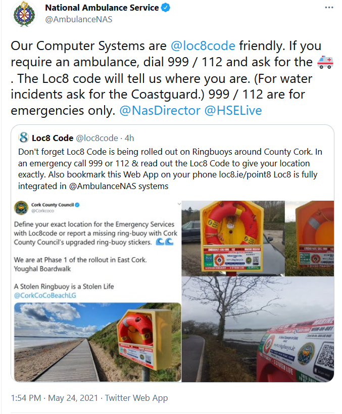 If you are reading this post, please #checkyourcode , advise others to do so also and please do it for those who can't. We are very happy to help and you can make contact with us here -/> 19/9/2022 Fixing Eircode Misrouting in Google Maps May not Fix the Problem for the Ambulance Service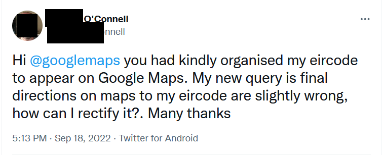 Evidence of Eircode misrouting continues and neither the Dept of Communications nor Eircode (Capita) are warning the Public about it. We know that people who notice that their Eircode is not in Google Maps are being told by Eircode to contact Google themselves. People are not being told to check for misrouting and our last post shows that at least one person received an admission from an advisor to Minister Hildegarde Naughton that Eircode can have problems (misrouting) when used in navigation systems but, again, their advice is to contact the mapping or navigation company yourself to sort it out. We have already highlighted how this is an abdication of responsibility by those responsible for Eircode so let's leave that for now. What is more important to highlight is that if you manage to solve misrouting in Google Maps by communicating with Google itself, that DOES NOT address the possibility of misrouting for the Ambulance Service. The Ambulance Service uses the "CoPilot" navigation system in its data terminals in response vehicles. This DOES NOT use Google Maps. It instead uses Trimble Maps. So if a misrouting issue exists in that, then it will remain. You can try contact Trimble Maps here -/> Of course, logistics companies and other 1st responders may well use other solutions using other mapping systems which would all have to be contacted individually to try ensure nobody trying to find your property is led astray by Eircode induced misrouting. It is important to understand that not everyone uses Google Maps and that professionals whose work involves road navigation very often have dedicated systems suitable for their differing needs. Furthermore, this does not take into account that there may be several different access points to your location with only one appropriate for different service providers or at different times of the day. Contacting all the mapping companies in the world will never resolve this. The only solution would be to be able to move the location of an Eircode so that it can positively identify the required access point. However, the rules enforced by An Post over the use of Eircode prevent that from happening. It should also be noted that even if you do make contact with every mapping company and they agree to help, it can take time (months) for them to apply corrections, then to disseminate them in their databases, then for navigation companies to apply updates and then for the user to ensure their product is updated as well. Meanwhile, those serving you will still be misrouted whilst all that is going on. An immediate solution is to use a Loc8 Code which can be placed just inside the desired access from the nearest mapped public road and no matter what mapping is used, the service provider or emergency responder will always be guided to the correct access point. If there is any ambiguity at that point then the property owner simply has to put up a sign confirming arrival at the correct Eircode or Loc8 Code or Property name and perhaps adding a directional arrow to the sign if required to guide the way to the final destination. Property occupiers do have to take some responsibility in that regard. You can generate a Loc8 Code for any location at this link and, after clicking on the desired spot and generating a Loc8 Code, by pressing the "Route" option you can also prove that the routing will guide to the right location. Loc8 Code is fully integrated into the response systems of the National Ambulance Service side-by-side with Eircode. Loc8 Code offers a FREE WebApp which can be used on multiple devices. In summary, please do not assume that if you manage to solve misrouting in Google Maps that that is the end of misrouting issues. The problem may still remain for Ambulances, other emergency responders and others trying to get to you. However, at least if you are aware of the problem you have some chance of resolving it. It remains that fact, though, that many are not aware because they have not been warned by those behind Eircode. All of the Department of Communications, their Minister and Eircode (Capita) know that the problem exists but to date have chosen not to warn the public to check their code for misrouting or other issues. 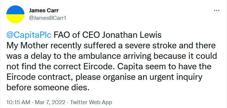 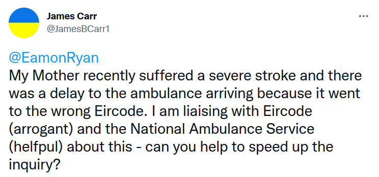 Regrettably, we are yet again reporting another recent case of an ambulance being delayed as a result of Eircode. We have investigated the cause and have confirmed that this is another case of Eircode misrouting. Firstly, let us assure readers that in spite of the related delay, the woman involved is recovering well thanks to the expert work of National Ambulance Service paramedics when they got to her. We wish her a speedy recovery and congratulate her son for all that he did to ensure his mother got quick medical care. This misrouting issue was caused once again by the fact that Eircode simply identifies a location and does not take into account the route by which that location can be accessed - i.e. it gives no clue as to where the access is and, due to inflexibility of design, cannot be adjusted to do that. In this case, the navigation mapping used by the Ambulance Service calculated a route via the nearest mapped road on its system to the Eircode location. This is how navigation systems normally work. There was no access from this location and, therefore, paramedics then had to go through a process of checking if they have the right code and finding a different way to it;- all using up valuable time. Time, as you know, is absolutely critical when it comes to a stroke patient. Capita PLC, which trades in Ireland under its registered business name of Eircode, has admitted in email exchanges that Eircode has no routing capability and then proceeds to suggest how multiple international mapping & navigation companies can be contacted by the property owner to ask them to resolve the issue. This of course suggests that the problem is with those companies and not Eircode. Let us spell it out again.................................................... those companies DO NOT CLAIM in a Public Service Announcement broadcast, at license payer's expense on RTE networks every year during January to March since 2016 (broadcast just finished for this year), that their product "may help an ambulance find you faster." Those companies acknowledge that their routing solutions can be sometimes less than perfect due to variations and inaccuracies in mapping. However, none of them designed a National Postcode over the period 2005 to 2014, with a current cost to the Irish exchequer of over €50M;- completely ignoring what is navigation industry knowledge and without reference to navigation experts. Furthermore, those companies have not ignored multiple well documented requests that Eircode should warn people of possible errors in their codes with the possibility of misrouting and encourage them to check their code at least once before relying on it in an emergency. Not only has the Department of Communications & Eircode (Capita PLC) ignored requests to include the warning in their adverts, in a response to a letter to them in 2021 on the subject, the Head of the Eircode Division in the Department of Communications, Mr. Ben King, implied that misrouting did not occur because the Ambulance Service uses Ordnance Survey Mapping. There are three aspects to this response & inherent implication as follows:-
There are short, medium and long term solutions to this misrouting issue which can be applied (some here on our site) BUT the very 1st step is for all those behind Eircode to start admitting that there is a problem and to warn the public about it. There is a quick short term solution which is already supported by the Ambulance Service and mentioned on this website. Very simply put, if the Eircode advert broadcast as a Public Service Announcement Free of Charge on RTE over the last 8 weeks had included a simple warning to the Public to check their codes and to use this website to help them do it, then this incident of Eircode misrouting could have been avoided. Likewise, this misrouting incident which also happened this February could also have been avoided. 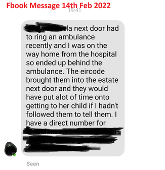 RTE has also been advised of this issue but has chosen not to apply any due diligence to the nature of advertisements broadcast on their networks as Public Service Announcements. It is RTE's assertion that once a Government agency tells them to broadcast something as a Public Service Announcement, they will do it without applying any oversight criteria. It is not good enough that Eircode (Capita PLC) and the Eircode Division in the Department of Communications is not warning people of this problem but it is also not good enough that they are not ensuring new & corrected Eircodes get to Google Maps in a timely manner either. This means that 1st responders do not know that if they are using Google Maps, a new Eircode may not be there at all or, if a correction has been undertaken by Eircode to adjust the location of a code, this also may not have been applied in Google Maps causing them to be guided to the wrong location. In the last week, two newspaper articles have confirmed that An Post's post men and women cannot use Eircode to deliver letters;- something that was established by then Deputy Hildegarde Naughton as Chair of the Oirecahtas Communications Committee in 2017/18. She did nothing and told no one about this at the time. The issue of Eircode misrouting has been raised since 2015 and we continue to hear of new examples where ambulances are delayed and patients put at risk but the same Hildegarde Naughton TD, who is now the Minister with Responsibility for Eircode, is not doing anything about that either. 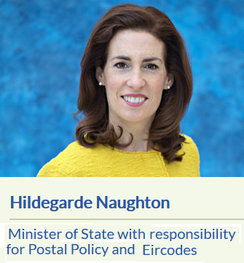 We at checkyourcode.ie have the expertise to help solve these problems and are more than willing to help the National Ambulance Service & Public representatives make it happen. Please let us do this together before someone loses their life as a result.
17/8/2021 Reports of Eircode Mis-Routing ContinueWe urge the Department of Communications & Minister Hildegarde Naughton TD, who has special responsibility for Eircode, to warn the Irish Public about this so ambulances & other emergency responders are not mis-routed in the event of an emergency.  There continues to be many many examples of this, most of which never get reported as people assume that they made a mistake themselves or their "GPS" was not working properly. See below for the latest examples reported on boards.ie The idea that Eircode can mis-route has been identified since at least 2015. For that reason, if the Department of Communications Officials and their successive Ministers;- Alex White, Denis Naughten, Richard Bruton and Eamon Ryan, had acted responsibly;- everyone in the country would know about it and would have checked their code by now. Minister Hildegarde Naughton;- the ball is in your court now & it is never too late to do the right thing. 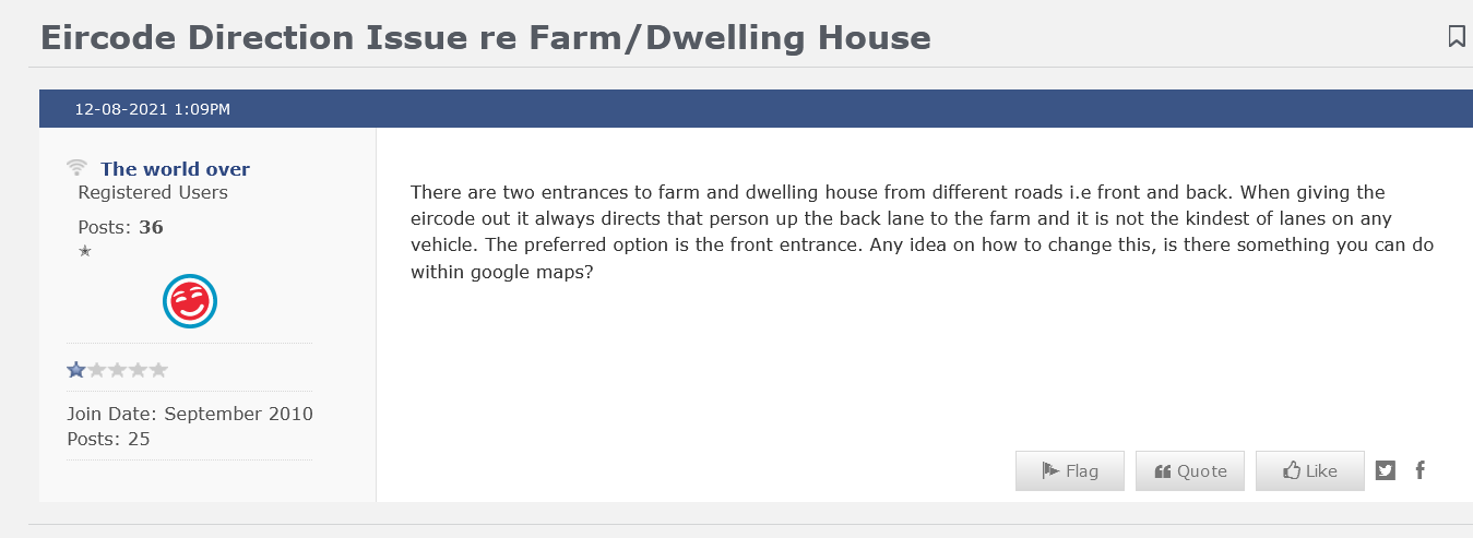 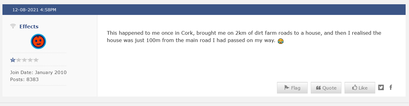 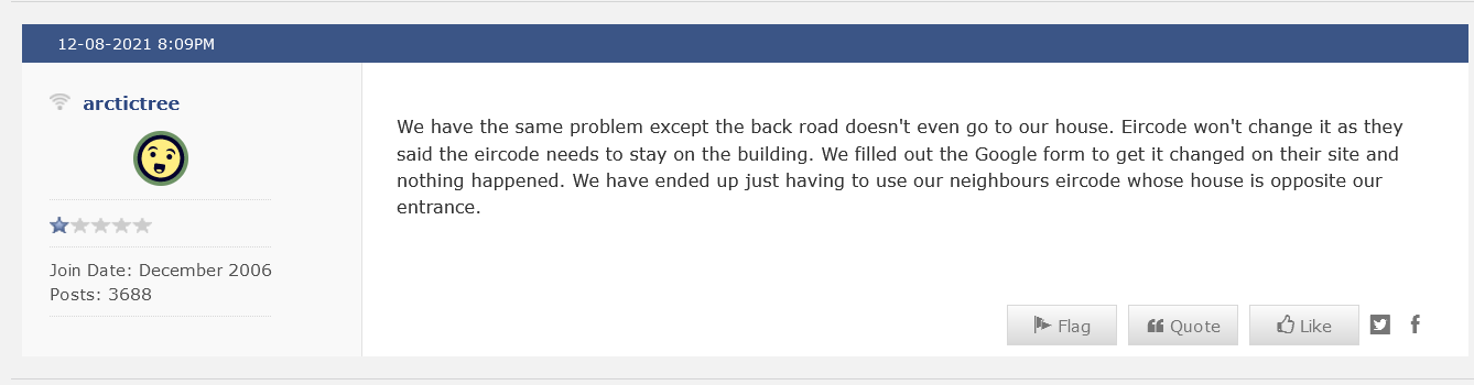 21/5/2021 More Evidence of Eircode MisroutingMore & more evidence of Eircode causing vehicles to be mis-routed away from the correct address is becoming available;- causing missed or incorrect deliveries, missed broadband or utility connections/repairs and delays for 1st & emergency responders Letters to senior Officials of the Department of Communications in January 2021 raising the issue with them and asking that warnings be applied to Public Service Announcements were not successful. They chose not to tell anyone about the issue which can be easily resolved if people are made aware. As a result, people are still taken by surprise as a result of Eircode mis-routing and are unaware that it can be resolved to everyone's benefit. This article explains the issue and this page explains how to identify and resolve it |